Project title: Flood hazard and flood risk mapping for the Danish implementation of the EU Floods Directive
Project duration: 2018 - 2020
Client: Ministry of Environment and Food of Denmark/Danish Coastal Authority
Contracting Authority: Ministry of Environment and Food of Denmark/Danish Coastal Authority
Countries: Denmark
General Objective
The project was part of the implementation of EU Floods Directive (Directive 2007/60/EC) in Denmark. In Denmark, it is the responsibility of the government to identify areas of potential significant flood risk and to map the flood hazard and flood risk in these areas.
Specific Objective
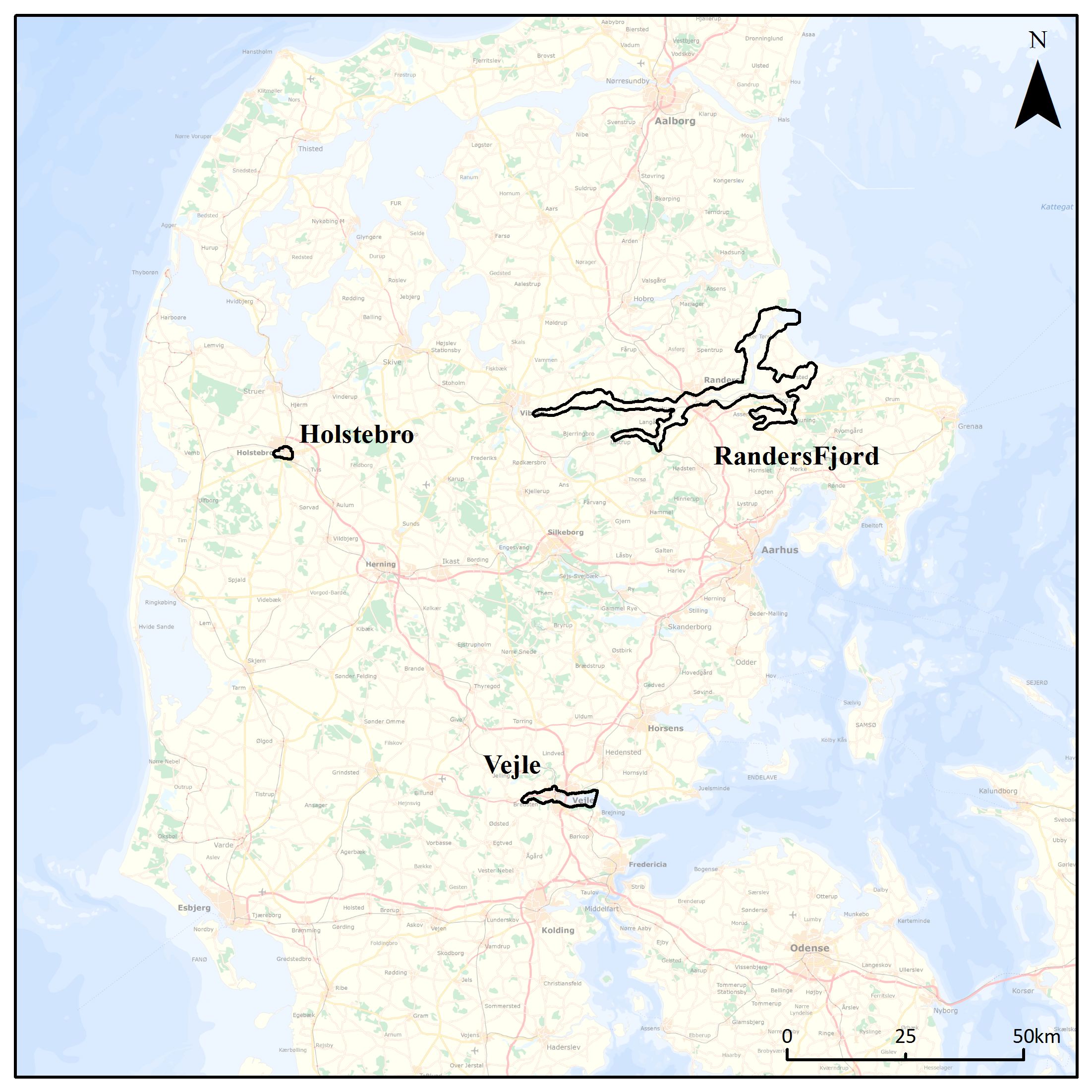
The purpose of the project has been to properly represent the flood challenges in the 14 areas of significant risk in Denmark, of both current small flood events and possible future extreme flood events. In this way, the models are forced with extreme conditions that must still result in realist flood scenarios used for flood risk planning in the municipalities. AXI HYDRO SOLUTIONS SRL has been responsible for 3 of the 14 significant risk areas in Denmark: Holstebro, Vejle and RandersFjord.
The flood hazard maps are based on dynamic hydraulic flood modelling in each area of risk, using the high-resolution Danish terrain model, adjustments by the municipalities, measurements of rivers, embankments etc. The flood maps are determined for several scenarios in each area, ranging from current high probability events to future very low probability events, and in some fiord areas, also combined events, with flooding for the river and sea happening at the same time.
Size of projects
• Holstebro: the river basin has 752 ha, 19km rivers: Storå river 5km (1D+2D), Vegen Å river 14km (1D+2D).
• Vejle: the river basin has 3836 ha, 15 km rivers: Vejle Å river 10km (1D+2D), Højen Å river 2km (1D+2D), Grejs Å river 3km (1D+2D); the coastline has 31 km.
• RandersFjord: the river basin has 32034 ha, 87 km of rivers: Nørea river 40 km (2D), GudenÅen river 20 km (1D+2D), Alling Å river 27km (1D+2D); the coastline has 103 km.
Services provided by AXI HYDRO SOLUTIONS SRL:
• Provided support in creating the methodology of the implementation of the EU Floods Directive in Denmark;
• Prepared and carried out the needed modelling work;
• Provided the hazard and risk mapping need for the preparation of flood risk management plans.
Results publication
Project title: Strength assessment of the Danish dikes
Project duration: 2018 - 2020
Client: Ministry of Environment and Food of Denmark/Danish Coastal Authority
Contracting Authority: Ministry of Environment and Food of Denmark/Danish Coastal Authority
Countries: Denmark
General Objective
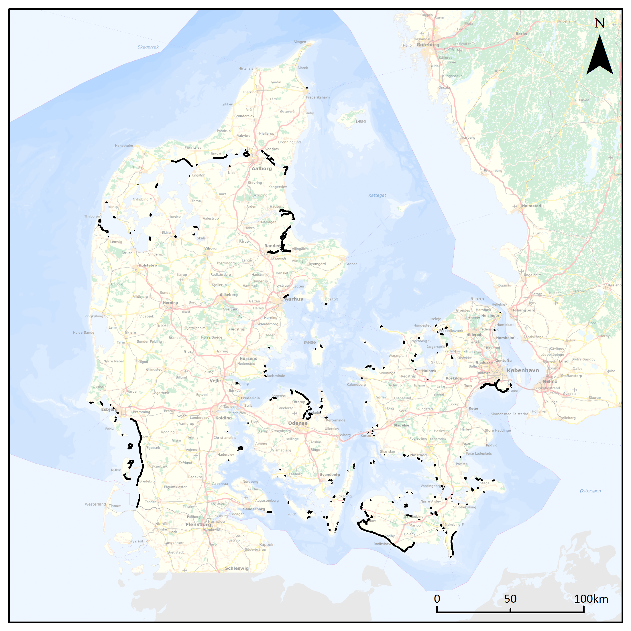
The overall objective is the implementation of a national dike strength assessment, which the Danish government adopted in 2017. The project includes a national strength assessment of all Danish coastal dikes. The risk assessment must form the basis for a forward-looking management of these risks in the coastal zone and will allow for planning in the coastal zone taking into account the consequences of climate change. The assessment included 460 km of dike length.
Specific Objective
The national risk assessment includes an assessment of the safety of all sea dikes that protect the population and their values, as well as the infrastructure in the coastal hinterland against flooding. The assessment include the identification of geometrical and hydrodynamic parameters.
Services provided by AXI HYDRO SOLUTIONS SRL:
• Detailed geographical mapping of dikes;
• Extraction of dikes geometric profiles;
• Develop GIS-based methods for calculating the dike strength;
• Develop data quality management tools in GIS - contributes to an efficient process in the national risk assessment.
Project title: InterReg project FAIR
Project duration: 2019 - 2020
Client: Ministry of Environment and Food of Denmark/Danish Coastal Authority
Contracting Authority: Ministry of Environment and Food of Denmark/Danish Coastal Authority
Countries: Denmark
General Objective
The overall objective is to reduce flood risk across the North Sea Region (NSR) by demonstrating climate change adaptation solutions to improve the performance of flood protection infrastructure. The flood protection infrastructure needs renovation, adaptation, and maintenance all across NSR.
Specific Objective
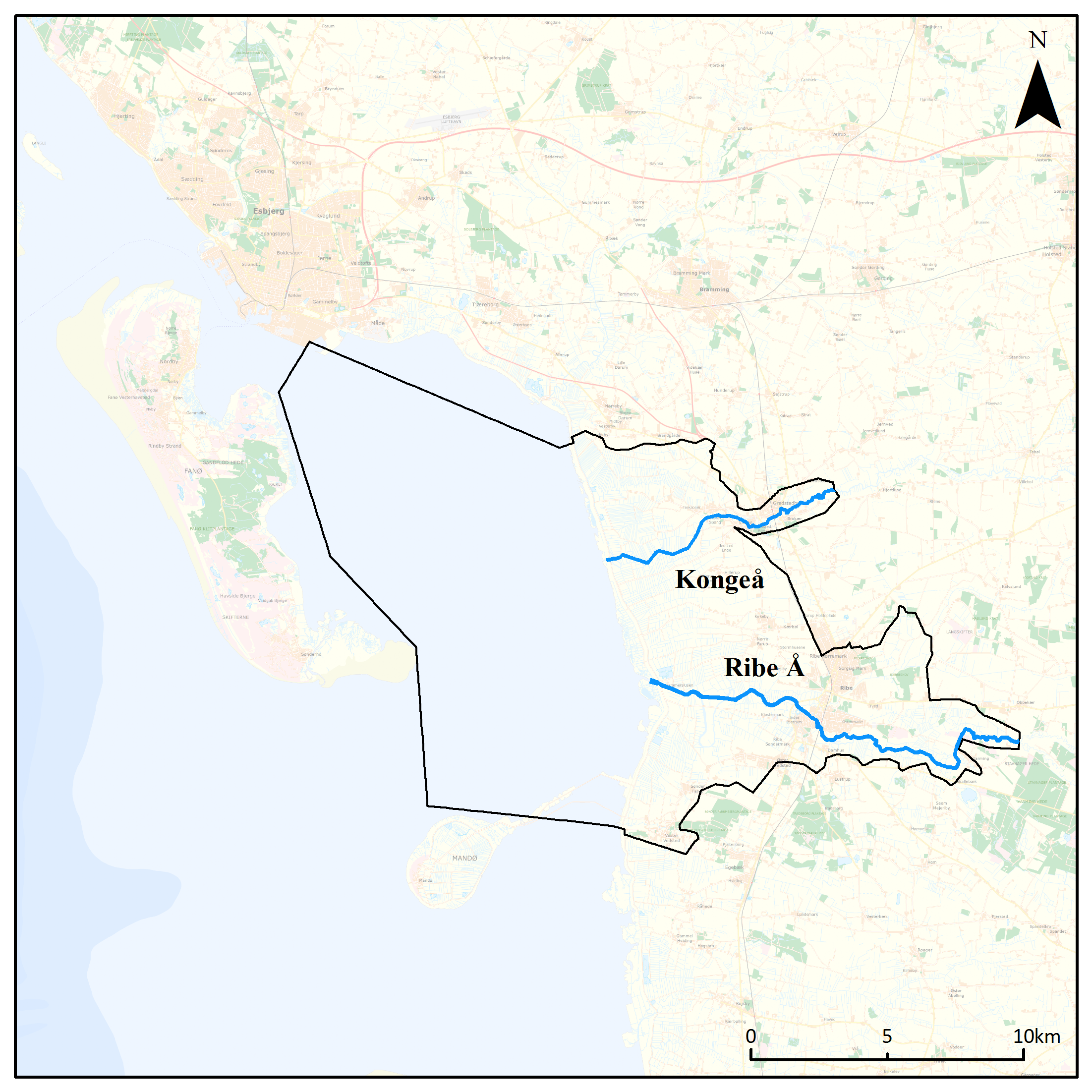
Ribe is the oldest city in Denmark and is located on the Danish North Sea coast approximately 7 km inland. The city has a considerable challenge in regards to lack of maintenance of flood infrastructure. Many dikes have to be rebuilt or renovated to uphold the required security of the hinterland.
Services provided by AXI HYDRO SOLUTIONS SRL:
• Responsible to properly represent the flood challenges in Ribe (24898ha), Denmark;
• Prepare and carry out the needed modelling work - Ribe Å and Knogeå rivers (27km) and 41 km of coastline;
• Provide the hazard and risk mapping.
Project page